• Can't post after logging to the forum for the first time... Try Again - If you can't post in the forum, sign out of both the membership site and the forum and log in again. Make sure your COG membership is active and your browser allow cookies. If you still can't post, contact the COG IT guy at IT@Concours.org.
  • IF YOU GET 404 ERROR: This may be due to using a link in a post from prior to the web migration. Content was brought over from the old forum as is, but the links may be in error. If the link contains "cog-online.org" it is an old link and will not work.

2016 National Riding & Routes

worncog

Member
Member
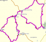
As the COG 2016 National Rally begins to form on the far horizon, I know that some of you are chomping at the bit to see what rides and routes will be available to you during your visit. The combinations are endless, but I have attached a sampling of the routes that will be at your disposal during your visit to 'Our Backyard' in Helen, Georgia.

More to follow...
 
Old Man on a Connie said:
I gotta do Krambonz after all I've heard.  :great:
I've ate there at least 8 times & have been disappointed every time !!. While the food is not bad it's far from GREAT or AWSOME. They are just average okay BBQ. Maybe I'm just spoiled living in the south with many places with great BBQ. I guess Krambonze is probably mouthwatering to people visiting the area that are not used to GREAT BBQ  :rotflmao:
 
Here are a few I've been to over the years & can recommend. Smokin Gold BBQ, Dahlonega Ga., Bub-Ba-Q, Jasper Ga., Lazy Bear BBQ, Gainesville Ga.  Webo's BBQ Asheville NC. ,  Fat Buddies BBQ Waynsville NC., Oakwood Smokehouse Lady lake Fl., Porkie's Original BBQ Apopka Fl., Also in my travels Just about any road side BBQ stand in the south operated by an older African American gentleman !!  :beerchug:
 
I think I've been to webos and Fatboys, Ya gotta lay them out for us to follow.  :great: :beerchug:
 
Zarticus said:
Here are a few I've been to over the years & can recommend. Smokin Gold BBQ, Dahlonega Ga., Bub-Ba-Q, Jasper Ga., Lazy Bear BBQ, Gainesville Ga.  Webo's BBQ Asheville NC. ,  Fat Buddies BBQ Waynsville NC., Oakwood Smokehouse Lady lake Fl., Porkie's Original BBQ Apopka Fl., Also in my travels Just about any road side BBQ stand in the south operated by an older African American gentleman !!  :beerchug:

Mr. B's BBQ in northern VA (south of Berryville, so close to me) is run by an African American family, started by the great grandfather. Grandfather, father, sons, daughters work it. They first had a cement block place a bit further down the road, but got so popular they moved to a newer, larger place.

The ovens and fire boxes, etc., went with them. I asked how old the ovens and smokers and fire boxes were, and they think they are at least 100 years old.

Anyway, its good Q, and I love Q, so looking forward to your road side BBQ stands down there.
 
Ok I downloaded the routes and I tried to open them in Garmin base camp and I got an importing unknown error? Any ideas? :'(
 
I don't know if this helps 'cuase I'm not that shmart. I renamed the file after downloading and removed the little squiggle. It opened in Tyre. Haven't tried the garmin stuff yet.
 
Well isn't that special.  :eek:

Sorry. I reloaded them after clearing 'squiggle'. Hmmm...They open in S&T, but not basecamp. Hate it when this stuff perks up when I have one eye open.

 
Well poop. Didn't help in basecamp ,mapsource or streets and trips. Still works in Tyre though. Dang, thought I was onto something.
 
A .gpx is portable between devices and software, its a standard format. Apparently these are not real .gpx files.
 
OK. Files do have an issue not allowing other applications to open remotely. Hhmm... :??:

Recreated a couple routes in Basecamp, but now they are too large to post here. I have created and transferred at least a couple hundred routes in S&T using three different computers pushed to three different devices with no glitches, but have not had the need to share till now, so I'm scratching my head on this one. Suggestions?

OK. Please try the attached file. Generated new in Basecamp. This is a 'chicken strip' removal route...well, and the Super Loop too.
 

Attachments

  • 11. Six Gap 80 per loop.gpx
    201.5 KB · Views: 112
Not any more. They sold it last year.
And it,  :(  well, sadly, it is no longer 'good' bbq.
The stuff you get in tubs at the grocery store is better quality and taste then what I had last year heading to Brrr...
Their beans...ugh.
May have been just a bad day for the cooks, but it was definitely NOT 'return trip' stuff.

What was once 'the' BBQ place has been removed from the list of even acceptable 'bbq'.
JMO, YMMV

JR said:
Mr. B's BBQ in northern VA (south of Berryville, so close to me) is run by an African American family, started by the great grandfather. Grandfather, father, sons, daughters work it. They first had a cement block place a bit further down the road, but got so popular they moved to a newer, larger place.
The ovens and fire boxes, etc., went with them. I asked how old the ovens and smokers and fire boxes were, and they think they are at least 100 years old.
Anyway, its good Q, and I love Q, so looking forward to your road side BBQ stands down there.
 
Old Man on a Connie said:
I gotta do Krambonz after all I've heard.  :great:

The ribs I had there last summer were probably the best ribs I've ever had anywhere.  They were REALLY good.  for chopped pork bbq, it was good, but the ribs were definitely the way to go.  I know Al raves about ribs in St Louis, but the ones I had there when I stopped through last June from the national were not as good as what I had at Krambonz.  Perhpas I just just hit Krambonz on a great day and the place in St Louis on a bad one.  either way, I recommend the ribs.  :great:
 
millerized said:
Not any more. They sold it last year.
And it,  :(  well, sadly, it is no longer 'good' bbq.
The stuff you get in tubs at the grocery store is better quality and taste then what I had last year heading to Brrr...
Their beans...ugh.
May have been just a bad day for the cooks, but it was definitely NOT 'return trip' stuff.

What was once 'the' BBQ place has been removed from the list of even acceptable 'bbq'.
JMO, YMMV

JR said:
Mr. B's BBQ in northern VA (south of Berryville, so close to me) is run by an African American family, started by the great grandfather. Grandfather, father, sons, daughters work it. They first had a cement block place a bit further down the road, but got so popular they moved to a newer, larger place.
The ovens and fire boxes, etc., went with them. I asked how old the ovens and smokers and fire boxes were, and they think they are at least 100 years old.
Anyway, its good Q, and I love Q, so looking forward to your road side BBQ stands down there.

Are talking about Mr. B's BBQ ?
 
Zarticus said:
Here are a few I've been to over the years & can recommend. Smokin Gold BBQ, Dahlonega Ga., Bub-Ba-Q, Jasper Ga., Lazy Bear BBQ, Gainesville Ga.  Webo's BBQ Asheville NC. ,  Fat Buddies BBQ Waynsville NC., Oakwood Smokehouse Lady lake Fl., Porkie's Original BBQ Apopka Fl., Also in my travels Just about any road side BBQ stand in the south operated by an older African American gentleman !!  :beerchug:

I'm surprised you didn't mention Jims Smokin Que on 19.  Had some there last fall while at RWTW.  good ribs!
 
JR said:
Are talking about Mr. B's BBQ ?
What 'was' Mr. B's.
Now High Hill Bakery & BBq...or something like that.
NOT what it was, and no longer on the list.
Gonna miss that place.
 
Hickory Stump BBQ - halfway from Helen to Suches, GA

Rick's Smokin' Pig  - Gainesville

Johnny's BBQ  -Gainesville (best of all) (closed Mondays)

Smokehouse BBQ in Oakwood GA


If you go to Krambonz, get the brisket. Best I ever had.
 
Hey Handyman,
          the new one worked for me in Basecamp. :great:
 
BigK said:
Hey Handyman,
          the new one worked for me in Basecamp. :great:

Thanks Kevin! I'll get a couple more up here as soon as I get some breathing room. Supposed to rain tomorrow, which gives me some time.

Randy
 
Confirmed basecamp, mapsource and tyre. No joy in streets and trips but really don't use that anyway.  :great: :beerchug:
 
Also - Downloaded and opened in Base-Camp so I concur with Mark it indeed worked - Very nice -  I'll try loading on 590 next...Looks like a really nice ride ... Thanks a ton for posting it up on the forum  handyman :)


Attachments

  • 6-Gap-80.png
    6-Gap-80.png
    98.6 KB · Views: 106
Ok Peeps, here are a couple more to take a peek at. Please let me know if they load okay.

I have several more, but they are too large for here. They will be on the webpage very soon in bulk.

Randy
 

Attachments

  • 6. The Dam Tallulah Falls Loop.gpx
    240.7 KB · Views: 103
  • 7. Crazy Eight.gpx
    266.4 KB · Views: 94
  • 9. Brasstown Bald.gpx
    49.1 KB · Views: 99
  • 10. Chicken Strip Eraser.gpx
    225.5 KB · Views: 103
Sport Rider said:
Randy....can you post all the routes here if it's not too much trouble?  I found a web based viewer that I can see them.  Others might find it useful for a quick look at them too....

http://www.gpsvisualizer.com/

I can send them to you tonight. Most of them are too big for posting here.

Here are a couple more. The BIG rides are too large for here.

Randy
 

Attachments

  • 1. Wheels Through Time.gpx
    184.3 KB · Views: 92
  • 12. The Gauntlet.gpx
    277.1 KB · Views: 95
Rode about 100 miles around that area after work today. Y'all are gonna like this..... ;)
 
Could y'all add tracks to these gpx files? My good olde 76cx doesn't play nice with jest routes. Thanks
 
Paulie said:
Could y'all add tracks to these gpx files? My good olde 76cx doesn't play nice with jest routes. Thanks

Anything for you Paulie! 😉

I'll see what I can do. 
 
Thank you for mapping & posting all the routes Randy---- Very helpful indeed....

Its a Way-Cool-Tool -

Mitch
 
MotoCommuter said:
Routes are up on the rally web site.

Thank you Randy & Robert!!
I visited the rally web site and see the routes. They are labeled as GPX files but they appear as XML files. I'm pretty sure I know how to download a GPX files and load it on the GPS because I had no issues loading the COG NE Spring Fling routes from the COG library. Any suggestions if I'm doing it wrong?  Could be a browser issue? 
 
4Bikes said:
MotoCommuter said:
Routes are up on the rally web site.

Thank you Randy & Robert!!
I visited the rally web site and see the routes. They are labeled as GPX files but they appear as XML files. I'm pretty sure I know how to download a GPX files and load it on the GPS because I had no issues loading the COG NE Spring Fling routes from the COG library. Any suggestions if I'm doing it wrong?  Could be a browser issue?

Are you just double clicking on the GPX link? If so, right click on the GPX link and select "Save Link As". Should open windows/file explorer for you to save to your PC.
 
Sorry Kurt.  As an IT guy, it's a bit awkward being on the question asking side of a computer.  :truce:  The GPX links when opened, open as an XML file.  When the target is saved, it saves the files as an XML file, and there are no other choices for the file extension.  If I open the file as the XML, and try to save as a .gpx it still is not recognized by Basecamp.  When trying to load that saved XML document into Garmin Basecamp, XML is not one of the file types it recognizes.

Can I make a suggestion?  Can you zip up all of the GPX route files, and offer that as a single click download option?  I have a hunch that it will take the browser recognizing the GPX as an XML file out of the equation.  It will also allow one download for all of the route files.  Is that possible on your end? thanks.
 
4Bikes said:
Sorry Kurt.  As an IT guy, it's a bit awkward being on the question asking side of a computer.  :truce:  The GPX links when opened, open as an XML file.  When the target is saved, it saves the files as an XML file, and there are no other choices for the file extension.  If I open the file as the XML, and try to save as a .gpx it still is not recognized by Basecamp.  When trying to load that saved XML document into Garmin Basecamp, XML is not one of the file types it recognizes.

Can I make a suggestion?  Can you zip up all of the GPX route files, and offer that as a single click download option?  I have a hunch that it will take the browser recognizing the GPX as an XML file out of the equation.  It will also allow one download for all of the route files.  Is that possible on your end? thanks.

I think it's how your PC is recognizing the GPX file, when I save link as, it saves as a GPX file. I'll have Robert, our Rally IT guru see if he can make the zip file of all the GPX files. But do me a favor if you can, go to another PC and see what happens when you try to save the file. Also, did not mean to insult you on the Save Link As but our members can be some what technology challenged at times.

Also, what browser are you using? Maybe try another one.
 
MotoCommuter said:
4Bikes said:
Sorry Kurt.  As an IT guy, it's a bit awkward being on the question asking side of a computer.  :truce:  The GPX links when opened, open as an XML file.  When the target is saved, it saves the files as an XML file, and there are no other choices for the file extension.  If I open the file as the XML, and try to save as a .gpx it still is not recognized by Basecamp.  When trying to load that saved XML document into Garmin Basecamp, XML is not one of the file types it recognizes.

Can I make a suggestion?  Can you zip up all of the GPX route files, and offer that as a single click download option?  I have a hunch that it will take the browser recognizing the GPX as an XML file out of the equation.  It will also allow one download for all of the route files.  Is that possible on your end? thanks.

I think it's how your PC is recognizing the GPX file, when I save link as, it saves as a GPX file. I'll have Robert, our Rally IT guru see if he can make the zip file of all the GPX files. But do me a favor if you can, go to another PC and see what happens when you try to save the file. Also, did not mean to insult you on the Save Link As but our members can be some what technology challenged at times.

Also, what browser are you using? Maybe try another one.
At home I run Windows 10 and tried it with Edge, IE, and Chrome.  The file when saving is an XML and can't be saved as a GPX.  I just tried it at work on a Windows 7 with the same results.  Zipping the files will likely solve the issue.  Thanks.

Edit to add:  Not complaining in any way, just trying to help out in case someone else is running into the issue.  And also, take your time.  It's not like it's hours before the start of the rally. 
 
Although putting them all in a ZIP file is probably the right answer, I thought I'd just mention that with Chrome on a Mac running 10.11 (El Capitan), left-clicking the link shows the XML content of the GPX file in the browser window, but right-clicking within the window and selecting Save As... will properly tag it with the .gpx extension. On the other hand, that method will put the browser escape "%20" in place of all the spaces, so the body of the file name is rubbish.

Of course, right-clicking the link on the COG page both saves directly as GPX and with the spaces in the file name preserved.
 
Ok, Robert, the Rally IT Guru, but up a link on the Route page to download all the files as a ZIP. Give that a whirl and see what happens.
 
MotoCommuter said:
Ok, Robert, the Rally IT Guru, but up a link on the Route page to download all the files as a ZIP. Give that a whirl and see what happens.
It now works perfectly and all of the route files show up as document type GPX.  Thanks guys. :beerchug:  :great:
 
MotoCommuter said:
Ok, Robert, the Rally IT Guru, but up a link on the Route page to download all the files as a ZIP. Give that a whirl and see what happens.

Just pulled the Zip - Loaded with your GPX & PDF files off the Rally Page -  worked great..

Thanks again- Mitch
 
handyman said:
Paulie said:
Could y'all add tracks to these gpx files? My good olde 76cx doesn't play nice with jest routes. Thanks

Anything for you Paulie! 😉

I'll see what I can do.

neva mind Randy, I figgered it out DIY style  :motonoises:
 
This may need a separate thread but it is riding at Nationals related.

Anyone seen the movie "Band of Brothers"?  Not far from Helen is Toccoa Ga where the Airborne guys from Columbus, GA that the movie is about did some training. I think the 506th is the unit number). After their training, they shipped out to England and they were housed in a stable before D-Day.

A few years ago, the people of Toccoa retrieved that stable and brought it to Toccoa and built a museum around it in the train station where the GI's disembarked for training at nearby Camp Toccoa. It is filled with period pieces, uniforms and the stable itself.  Camp Toccoa is long gone, but the museum is worth a day trip if you are interested in that little bit of history.

It's about a 30 mile ride from Helen.
Here's the website  http://www.toccoahistory.com/exhibits.html


loading routes into the 660, my computer nearly choked on the chicken strip eraser. took a while to recalc it. how long is that route?  and this is a really fast gaming rig so its gotta be some kind of route.
oh yes, i went and added a 16gig sd card just to hold all the routes and stuff. 
ive had this unit a year but just learning to really use it.
 
Max and all...  Can you verify by comparing with the PDF maps that when you recalculate the routes that the route does not change please?  Basecamp pulled them in fine but if recalculated the route it changed for me.  Max that may be why it took so long on that one.  Most GPS units recalculate the route when it is loaded so not recalculating may not be a fix.

Randy did you get my email Monday?
 
smithr1 said:
Max and all...  Can you verify by comparing with the PDF maps that when you recalculate the routes that the route does not change please?  Basecamp pulled them in fine but if recalculated the route it changed for me.  ...

The easiest way to see what changes when a route is recalculated is:

1. duplicate the route (right click the route and select "Duplicate")
2. change the color of the newly duplicated route
3. recalculate the newly duplicated route
4. select both routes (ctrl+click each one) so they are displayed at the same time.  If the routes are the same, you should not see one of the routes peeking out from behind the other.
 
smithr1 said:
Max and all...  Can you verify by comparing with the PDF maps that when you recalculate the routes that the route does not change please?  Basecamp pulled them in fine but if recalculated the route it changed for me.  Max that may be why it took so long on that one.  Most GPS units recalculate the route when it is loaded so not recalculating may not be a fix.

Randy did you get my email Monday?

I'll take a look at this. The smooth routes will be finalized soon with a few mods to increase device functionality. Also, a short list of POIs for the area with an emphasis on eateries will be posted.

Nice tip/method WG. This is turning into a learning thread of sorts.

Bob, I did. Albeit a bit late.
 
I was able to just view the route on the map and watch that I did not see changes at the end of recalculation.  If there was I just hit undo.  That is a faster way to know if you have enough points in the correct places. 

If you think it is a route someone will want to reverse then you also have to check that recalculates without errors also.
 
smithr1 said:
I was able to just view the route on the map and watch that I did not see changes at the end of recalculation.  If there was I just hit undo.  ...

Trying to notice the changes may work for small enough routes.  The larger your route, the larger the shift has to be during recalculation in order to notice.

Duplicating a route and recalculating it allows you to zoom in to whatever level you need to see whether they are identical.  In addition, seeing the exact details of where one route differs from the other, shows you exactly where to add the additional shaping points to make the routes identical ... whether there is one difference or one hundred.

In either case, checking the length of the route (both before and after recalculation) is an additional way to determine if you need to look closer for changes.  Note: that once a route gets over 100 miles, BaseCamp rounds to the nearest mile.  That means that two routes could be off by as much as a mile and still be reported as the same length.  That may be good enough for your purposes ... or not.  Each of us must decide.
 
WG said:
... BaseCamp ... may be good enough for your purposes ... or not.  Each of us must decide.

Afta spending way too much time with Basecamp, I got a good smiley for it:  :breakcomp:
 
As the National nears, I am seeing a glimmer of light, or at least a gap, in my home renovation schedule...finally. Translation: The FINAL edition of the routes will be posted very soon and I'll have time to get my preferred bike serviced and off my lift to ride at the National.

The final editions of the previously posted routes will have more waypoints to constrain the routes for better performance on various devices and will also be populated with RTE locations and a few popular POI's. I am also adding the direct routes to the RTEs for persons desiring those.

Hope that helps. And I do appreciate you fells wrestling with these to help improve the final product.

Randy
 
Randy on Super Loop and Day Ride do you think it will really take the 9-10 hours that the statistics for the route say it will?
 
smithr1 said:
Randy on Super Loop and Day Ride do you think it will really take the 9-10 hours that the statistics for the route say it will?

Very good question. Both of those routes are long and can be REALLY long if you are flower sniffing or stopping for anything other than a short lunch break. The Day Ride and Super Loop do have a lunch break identified in Tellico Plains or Nantahala respectively.  Bear in mind that almost all of those two loops are twisty and have posted speed limits ranging from 35 to 55mph. Riding these roads requires constant attention and could be considered advanced for new or novice riders. An important point being that the time it takes to cover the mileage required for either of these routes may well exceed the expected time allotted. To answer your question, yes it could easily take 9-10 hours to complete. 

I have ridden a version of the Super Loop at what most would consider a fairly brisk pace several times and it IS a long day. From Helen, one will cover Blood Mountain, Wolf Pen Gap, Ga 60, Cherahola Skyway, The Dragon, and Moonshiner 28. All of these are filled with corners ranging from wide sweepers to tight and technical with limited room for error.  When combined with an hour lunch break and a couple short stops, like the turnaround at the end of the Dragon, it can be a full day of saddle time. IIRC, I led a tight group on that loop last fall and we left fairly early and returned shortly before the dinner bell.

I would not plan either of these rides on Thursday for sure. ;)
 
Heads Up on Riding in the Northeast Georgia Area - The Georgia Department of Transportation staff has courteously supplied this information concerning their construction schedule in Northeast Georgia during the week of the Rally:

Crews will be paving on US129 that week from Cleveland to Neels gap during the day. 

There is a project starting that will pave thru Helen, but we will restrict their work hours to night time only during the rally.  Honestly, we don't expect them to start until July, so it shouldn't even be a problem. 

There is a potential that crews might be working that week finishing paving on 75 Alt from US 129 to SR 75.  This should be the only work that will have traffic impacts.


For this and additional travel information in Georgia, visit the GDOT Navigator website: http://www.511ga.org/

HTH,
The Rally Crew
 
Crews will be paving on US129 that week from Cleveland to Neels gap during the day.

Bummer. BUT that is only PART of the best roads!!! (But...it sure will be nice when it's a new surface!!!)
 
ron203 said:
Crews will be paving on US129 that week from Cleveland to Neels gap during the day.

Bummer. BUT that is only PART of the best roads!!! (But...it sure will be nice when it's a new surface!!!)

Well, that puts a twist on things. I'll see if I can adapt and adjust a few things. More to follow.

Randy
 
Bypass the section by:

Going South from Helen to Cleveland -> (this gets GOOD!) TR north on 129, TR on Alt 75 -> TL on Richard Russell Hwy 180, follow that to end-> TL go to 129 SOUTH/HWY 180 -> TR to Suches. Or at 129, TR to Blarisville and head on up to NC/TN and the Cherohala Skyway. Nice that way, too!

(IF you) TR when the Richard Russell ends and go to Brasstown Bald, Hiawassee, & NC.

If you dead end at Hwy 60 in Suches (above), Go L or R for awesome riding on 60.

Just turn off your GPS and ride!  :motonoises:
 
ron203 said:
Bypass the section by:

Going South from Helen to Cleveland -> (this gets GOOD!) TR north on 129, TR on Alt 75 -> TL on Richard Russell Hwy 180, follow that to end-> TL go to 129 SOUTH/HWY 180 -> TR to Suches. Or at 129, TR to Blarisville and head on up to NC/TN and the Cherohala Skyway. Nice that way, too!

(IF you) TR when the Richard Russell ends and go to Brasstown Bald, Hiawassee, & NC.

If you dead end at Hwy 60 in Suches (above), Go L or R for awesome riding on 60.

Just turn off your GPS and ride!  :motonoises:

And a yellow highlighter works well, too, I hear....
 
douglasjre said:
These routes look awesome. Anybody going offroad this year?

Ken is planning an off-road route. Marty tends to just find himself there from time to time....  :great:
 
douglasjre said:
These routes look awesome. Anybody going offroad this year?

Doug!

Wed @ 9:30 am with Ken Ford.

https://teamup.com/ks0b7417335e4477a7/

Check out the calendar - it's full of good stuff. Your buddy Dave Despain will be speaking twice  :great: Max from Traxxion is doing a suspension tech session. Addresses for the RTEs and lots of other useful info there.

Can't wait!  :beerchug:
 
+1

I was at Lucas Oil Speedway in Wheatland, MO last weekend with my Dad and brother for the Sho-Me 100 Late Models and Modifieds.  Dave was there broadcasting for MAV-TV and they showed pieces of the broadcast live on the Jumbotron.  I've always thought he was one of the top two or three motorsports broadcasters in the business.  Great voice, witty, personable, and totally knowledgeable on all forms of racing, both four-wheel and two.

Wow, this is a huge coup IMO!     
 
What is the best route from Chattanooga to Helen, GA?  I will be coming in to Chattanooga on I24 from the north on Sunday 6/19. 
 
SR said:
What is the best route from Chattanooga to Helen, GA?  I will be coming in to Chattanooga on I24 from the north on Sunday 6/19.

Do you want a twisty route that is not too far off direct? A route filled with twisty roads that is a little off direct?

And do you have a gps?

Randy
 
It doesn't really matter.  I do have a GPS.  From Suches last Sept I took US 64/74 to I75, but was wondering with the weekend rafting traffic.  I will either spend Sat night in ****son, TN or Murfreesboro, TN.  So I could also ride 2 lane from Murfreesboro.  I have ridden Hwy 30 in eastern TN.  I live in Northern Arkansas.
 
I24, , I75, 64, 129, 348, and 75alt would be the most direct.

Jumping off 64 onto 68, 60, 180, 129, and 75alt would be the most bang for the buck if you want a twisted warm-up for the week.

Randy
 
handyman said:
I24, , I75, 64, 129, 348, and 75alt would be the most direct.

Jumping off 64 onto 68, 60, 180, 129, and 75alt would be the most bang for the buck if you want a twisted warm-up for the week.

Randy

NOTE: There may be some construction underway on 129 and 75 alt. Plan accordingly.
 
How would US Hwy 64 to NC Hwy 175/75 and come into Helen, GA from the north?  That would avoid US 129 and alt 75 construction.
Steve
'99 Concours "Phurple"
 
Jack and I are riding a not so direct (sounds like a motorcycle ride :motonoises:) mostly secondaries from Lancaster/York PA. We are stopping in Charleston WV. There will be nothing but turns most of the way. PM me if you want the routes for the two days.
 
SR said:
How would US Hwy 64 to NC Hwy 175/75 and come into Helen, GA from the north?  That would avoid US 129 and alt 75 construction.
Steve
'99 Concours "Phurple"

NC 175/75 to US 76 to GA 17 into Helen would be smooth. If it were me, I would come east on US 64, drop south on 68 to 60, turn east on 180 and follow over to 17 south into Helen. A little curvier and a nice ride. Take your time on 68/60/180 if your loaded.
 
Greetings route masters.  I am somewhat new to the GPS thing and have a question....sorry in advance if this has been addressed and I missed it.

Will there be a way to download the ride-routes on a Garmin while at the National?  Not knowing weather and the riding appetite of our group from day to day, I was thinking it would be nice to load up the next days ride after the group has decided where we should go. 

I will not have a computer along....so maybe that is the key ingredient in being able to do this.  I was thinking of loading the routes before leaving....but not sure if my 665LM has capacity for all of them and my music.  Any thoughts, ideas or recommendations would be appreciated. 

Thanks!
 
1965soda I will have my laptop and have the routes on it and can help you with loading them in you gps if you end up needing it. Just look me up.
Kevin Myers
 
Fais said:
180 is a twist-fest  :motonoises: !

+1

Watch for bears (the real kind...) Almost hit a turkey there, too! Neat road with one curve where you can almost see your tail light as you go around it.. Lots of fun.
 
ron203 said:
Fais said:
180 is a twist-fest  :motonoises: !

+1

Watch for bears (the real kind...) Almost hit a turkey there, too! Neat road with one curve where you can almost see your tail light as you go around it.. Lots of fun.

You get a much better view of this phenomenom while riding the road in the dark, BTW. DAMHIK
 
Thanks Kevin! 

I really appreciate your offer of help.  I am going to see if I can get a bigger memory card to work in the Garmin and if so....I may be able to load most of those routes.  If not and if I need help loading routes while in Helen, I will do my best to track you down.

Thanks again!
 
1965soda said:
Greetings route masters.  I am somewhat new to the GPS thing and have a question....sorry in advance if this has been addressed and I missed it.

Will there be a way to download the ride-routes on a Garmin while at the National?  Not knowing weather and the riding appetite of our group from day to day, I was thinking it would be nice to load up the next days ride after the group has decided where we should go. 

I will not have a computer along....so maybe that is the key ingredient in being able to do this.  I was thinking of loading the routes before leaving....but not sure if my 665LM has capacity for all of them and my music.  Any thoughts, ideas or recommendations would be appreciated. 

Thanks!

Howdy!  I am playing with the routes now for my own use.  All of them only take up about 6mb  if you have any kind of card you should have room for that.  Music takes up a lot just delete the longest song.
 
Hi Bob.  Appreciate the help and suggestion.

I found that I actually have quite a bit of open space on the memory card in the Garmin (it was the internal space on the device itself that was nearly full).  I loaded the GPX files to the memory card and put it back in....but they would not come up when I selected custom routes.  I then tried loading them to Garmin basecamp and then loaded them to the memory card (while in the Garmin) and same thing...would not show up under custom routes.  I also tried going through the data option to see if there was any new data to upload but none existed.

Any thoughts on what I may be doing wrong?  Thanks for any help you can provide!
 
 
The 'smooth' versions of the posted routes have been reposted to the National page. Download in zip bulk format.

Tankbag route sheets in editable Excel format will be posted here soon, as well as being available at Rally Central.

Here is an additional item to chew on: Ethanol-free fuel at pure-gas.org. The Wolf Pen Gap Country Store indicates having 93 Ethanol Free fuel on tap. That is a stop on several of the routes.

Cheers,
Randy
 
If you have the time and skill I would get the new routes that the Handyman, Randy just posted.  I would then take them to Basecamp with your unit connected and be sure they recalculate the same on your unit.  If not correct you usually can correct it by only adding a point here or there. 

If it is way hosed when recalculated you could also try putting the un recalculated route in your GPS and view the route to see if it matches.  My older unit (26xx model) would force a recalculate and if the maps were different than the one it was made on it would change the route.  I am not sure my new one does that but it may on loading and just does not tell you.
 
Top