
-
WOULD YOU LIKE TO BE ABLE TO POST? REGISTER FOR COG MEMBERSHIP
All registration must be done through the club's main webpage: To register / join COG, click here
For instructions to convert to full membership, click here
-
Can't post after logging to the forum for the first time... Try Again - If you can't post in the forum, sign out of both the membership site and the forum and log in again. Make sure your COG membership is active and your browser allow cookies. If you still can't post, contact the COG IT guy at IT@Concours.org.
You are using an out of date browser. It may not display this or other websites correctly.
You should upgrade or use an alternative browser.
You should upgrade or use an alternative browser.
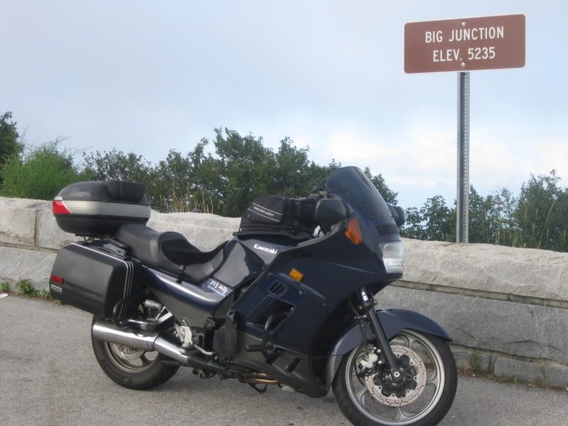
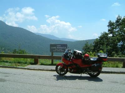
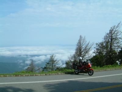
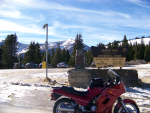
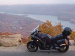
Summit Pictures
- Thread starter greg.m784
- Start date


Nice pics, looks like fun.
How did you get that screenshot of the GPS. I think that is cool. I have taken photos of mine before, but it always looked just like that... a photo of a GPS...
How did you get that screenshot of the GPS. I think that is cool. I have taken photos of mine before, but it always looked just like that... a photo of a GPS...
gfinca
Crotch Rocket
Hey, Greg, it looks like you made it up there after all :beerchug:. We stopped about 200 yards short of that sign for a picnic when we were up there a week and a half ago. I'm usually having too much fun riding to take pictures of pass signs, but I'll try to remember next time. ")
wally_games
Mini Bike
Greg said:What i'm really looking for is an app that i can plot my ride on using my laptop, then upload to the phone and run that route.
Can't you plot a route on mapquest.com and then send it to your smart phone?
greg.m784
Street Cruiser
wally_games said:Can't you plot a route on mapquest.com and then send it to your smart phone?
I've tried but i can't get logged into the mapquest website (and it's pissing me off).
sas mayhem
Street Cruiser
sas mayhem
Street Cruiser
Greg said:Nice color Connie.
I like that bag. it isn't too big, it isn't too small. What bag is it?
Here you go Greg
http://www.motorcycle-superstore.com/1/4/71/2521/ITEM/Fieldsheer-Contour-Tank-Bag.aspx, well worth every penny and more. And it will expand higher if needed, and comes with hard fold up or down walls on the inside. Very kool. I got the one with straps, since the magnet version are not available any more. I took the removable base and sliced the hems to insert some strong earth magnets and resealed them. That bag ain't moving.
Cheers
Ron
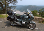
Here is one on the BRP on my way to the 2004 National in Johnstown PA
and another on the way home
and another on the way home


SAS Mayhem said:Greg said:Nice color Connie.
I like that bag. it isn't too big, it isn't too small. What bag is it?
Here you go Greg
http://www.motorcycle-superstore.com/1/4/71/2521/ITEM/Fieldsheer-Contour-Tank-Bag.aspx, well worth every penny and more.
And I thought Greg was asking about the top case. Givi, or Shad, or ? What size is it? The backrest pad looks functional too.
Great pictures, all. A few years ago my brother-in-law planned a ride in California he dubbed "Riding the Passes", all in California and in a six/seven time span. We criss crossed the Sierra several times, took a few pictures, but, alas, never enough. We did Tioga Pass, Sonora Pass, Ebbettes and Monitor Passes and Carson Pass.
Taking pictures is time consuming, but , as I grow older, well worth the time spent. And it's so much fun to look at later and during the winter.
So, to those of you who pack a camera, take pictures. You won't regret it.
Ride safe,
Taking pictures is time consuming, but , as I grow older, well worth the time spent. And it's so much fun to look at later and during the winter.
So, to those of you who pack a camera, take pictures. You won't regret it.
Ride safe,